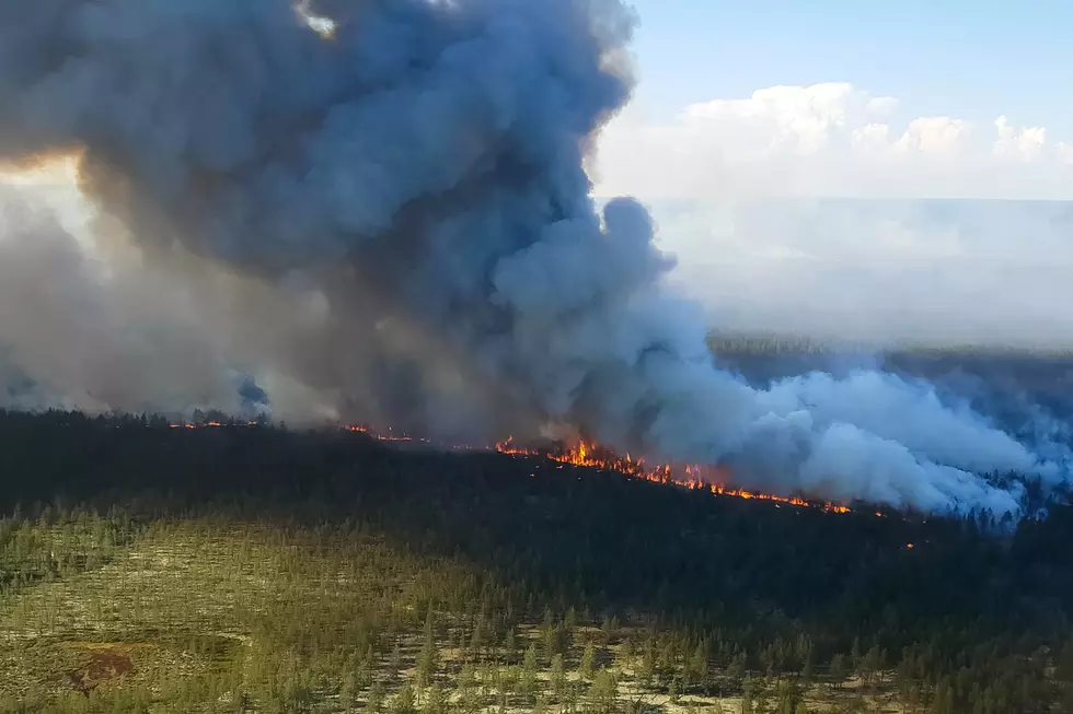
Pasayten Fires Burn Nearly 10,000 Acres
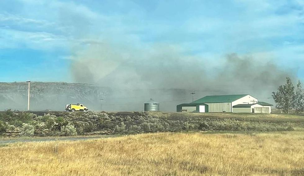
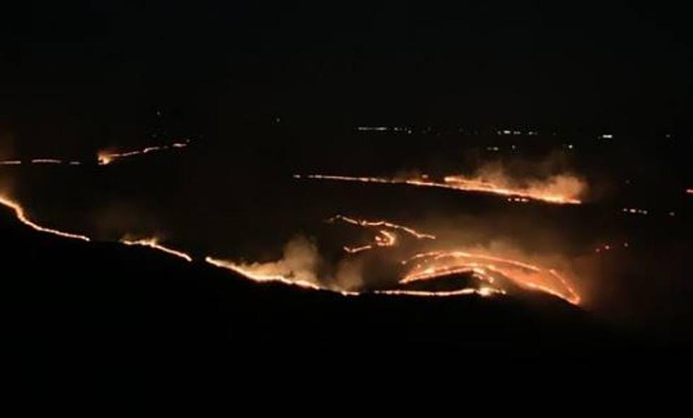
The Pasayten Wilderness Fires have grown to nearly 10,000 acres, combining two of the fires together.
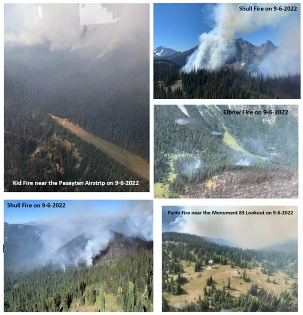
The nine fires within the Pasayten Wilderness Area are located on the Methow Valley Ranger District of the Okanogan-Wenatchee National Forest, as well as the Chilliwack Complex Fires within the North Cascades National Park Service Complex.
The Pasayten fires were discovered on Sep. 6, 2022, and were ignited by lightning strikes back on Aug. 11.
All of the fires have accumulated to 9,814 acres, with 15 personnel currently working on the fires.
The Kid and Parks fires combined during the weekend, amassing nearly 9,000 acres altogether.
The Three Fools fire is nearly doubled in size at 508 acres, moving upslope to the west.
Public Information Officer Kerri Green said that Sunday should be bringing increased moisture, with a chance of showers and cooler temperatures.
The following trails will be closed as crews work on these fires:
- Trail #454 Monument 83
- Trail #461 Border
- Trail #471 Point Defiance
- Trail #752B Dry Creek Pass
- Trail #472 West Fork Pasayten
- Trail #472.1 Holman Creek
- Trail #473 Rock Creek
- Trail #474 Eureka Creek from its junction with Trail #478 Robinson Creek to its junction with Trail #484 Monument Creek
- Trail #477 Hidden Lakes from its junction with Trail #485 Tatoosh Buttes to its junction with Trail #533 Boundary Trail
- Trail #478 Robinson Creek from its junction with Trail #474 Ferguson Lake to its junction with Trail #533 Boundary Trail
- Trail #482 Chuchuwanteen
- Trail #484 Monument Creek from its junction with Trail #474 Eureka Creek east to Shellrock Pass
- Trail #485 Tatoosh Buttes
- Trail #490 Heather Lake
- Trail #495 The Parks
- Trail #498 Buckskin Ridge from Silver Creek north to its junction with Trail # 478 Robinson Creek
- Trail #533 Boundary from its intersection with Trail #456 Dean Creek to its junction with the Pacific Crest Trail #2000
- Trail #576 Buffalo Pass
- Trail #738 Jackita Ridge from Devils Park in T. 38 N., R. 16 E., sec. 34 north to its junction with Trail #752 Devils Ridge
- Trail #749 Castle Pass from the boundary of North Cascades National Park in T.40 N., R. 14 E., sec. 3 to its eastern terminus at Pacific Crest Trail #2000 in T. 40 N., R. 16 E., sec. 19.
- Trail #749.1 Joker Mtn
- Trail #752 Devils Ridge
- Trail #752.2 Bear Skull
- Trail #754 Canyon Creek from the confluence of Slate Creek and Canyon Creek to its junction with Trail #752 Devils Ridge
- Trail #2000 Pacific Crest Trail from Windy Pass to its northern terminus at the U.S.–Canada border
More From 610 KONA